
Walk a Harvey Street Address
A useful Harvey street directory search moves from the place to the records, not from a name to a guess. A street address may be typed in several ways, while the Cook County parcel identification number, or PIN, stays tied to the assessed parcel. The Assessor supplies that key. CookViewer then checks the parcel shape and its neighbors. CRS, the Clerk's Recordings System, adds deeds and other filed instruments. Only after those steps should an individual voter confirmation or an old directory entry be weighed as evidence of residence.
- Enter the house number, street name, and Harvey in the Cook County Assessor address search. Copy the full PIN and the displayed property location.
- Open CookViewer, locate that PIN, and inspect the parcel and adjacent lots. Map layers help distinguish a city line, ward, district, and tax geography.
- Search the same PIN in CRS. Read each deed, mortgage, lien, release, or correction as a separate event.
- For one person who supplied identifying details, use the Illinois voter lookup. It confirms an individual registration, not everyone on the block.
- For an older occupant, ask the Harvey Public Library about its city-directory and telephone-book holdings, then cross-check the alphabetic entry.
The resulting chain is address to PIN to map to recorded document to occupant evidence. It can identify an owner, show a transfer, or place a listed person at an address in a given year. No single step proves the complete household.
Keep a small source log as the chain grows. For each result, note the office, search date, exact address text, PIN, document number, and the role attached to each name. Mark a person as owner, taxpayer, grantor, grantee, voter, applicant, or directory-listed occupant instead of using the broad label resident. This habit makes conflicting records easier to explain. It also keeps a later transfer from being mistaken for a current fact. If the address route returns no parcel, try the direction and street name without its suffix, then compare the city map. Do not force a match to a similar house number.
Search Harvey Parcels Precisely
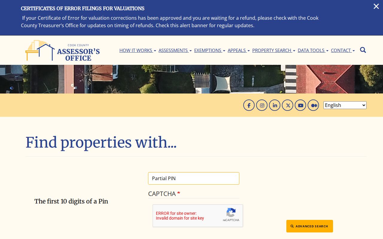
The Assessor offers separate PIN, address, and neighborhood paths. Harvey lies in Thornton Township. In an address search, omit the street suffix as the portal instructs and choose HARVEY as the city. The neighborhood route adds township and property-class filters, while advanced search can use a partial PIN, a house-number range, an appeal number, or an applicant name. A CAPTCHA must be completed before submission.
| Assessor field | Format | Street-search use |
|---|---|---|
| PIN number | Full 14 digits | Most stable parcel key; retain leading zeroes |
| House Number | Number or text | Required for the address route |
| Direction | N, S, E, W, NE, or NW | Narrows streets with the same base name |
| Unit Number | Optional text | Refines a unit when the parcel record supports it |
| Street Name | Name without suffix | Required address field |
| City | HARVEY | Keeps the query local |
| Township | Thornton | Required for the neighborhood route |
The advanced property search shows how these controls fit together.
Harvey Street Directory Sources
Address-keyed records answer different questions. The Assessor and tax portal focus on parcels and tax accounts. CookViewer supplies geography. CRS indexes legal instruments. Harvey's Building and Inspectional Services may hold a permit, inspection, or violation file tied to a street address, but no public permit-history index was found. A defined request by address, date, or permit number is therefore the practical fallback.
| Address source | Custodian | Evidence supplied | Access channel |
|---|---|---|---|
| Parcel card | Cook County Assessor | PIN, property location, class, values, neighborhood, taxpayer clue | Free portal; AINQ/ASIQ printout or FOIA fallback |
| Parcel map | Cook County GIS | Geometry, adjacent parcels, districts, zoning and flood layers | Free CookViewer; export and print controls |
| Recorded documents | Cook County Clerk | Grantor, grantee, document type, date, legal description, PIN | Free index; paid images or copies; office for older books |
| Tax account | Cook County property portal | Bills, payment context, address and PIN links | Free current portal; office request if needed |
| Permit or code file | City of Harvey | Applicant, contractor, address and inspection dates when public | Department request or municipal FOIA |
| Historic directory | Harvey Public Library | Listed occupant and address for a publication year | Call before an in-person shelf or microfilm visit |
This is why a street-by-street inquiry should preserve both the address and the PIN. The street name joins local files and old directories, while the PIN bridges assessment, mapping, tax, and deed systems.
The Cook County Property Tax Portal adds a separate tax-account view. It accepts a PIN or address and links to tax documents, bills, and payment context. Historical depth is not stated on its landing page, so a missing old bill should lead to the Treasurer or an office request. Tax status does not disclose who sleeps at the property. It simply adds a dated financial tie to the parcel and can help distinguish two lots with similar street labels.
Note: The property card's location line is expressly not a legal or postal mailing address.
Decode Harvey Address Records
Several terms prevent costly mix-ups. Read them before deciding that two records refer to the same place. An address can change in spelling or postal use; parcel and plat references often survive those changes.
- Parcel
- A mapped unit of land identified in Cook County by a PIN.
- Situs address
- The property's location for assessment purposes, distinct from the taxpayer's mailing address.
- Plat
- A recorded map that lays out lots, blocks, streets, or subdivisions.
- Criss-cross directory
- A directory arranged by street and house number, allowing an address-first search.
A legal description may use lot and block or section, township, and range instead of a modern street line. That distinction matters in Harvey, where early land records connect to Section Eight and the Illinois Central land division. If a street entry fails, compare the current PIN with the legal description and historic plat.
Map Harvey Streets in CookViewer
CookViewer is the visual bridge in the Harvey street directory. It locates an address or PIN, lets the user select nearby parcels, and exposes district and historical assessment layers. Selected results can be exported to CSV or Excel, and the viewer offers print or report controls. Those functions are useful for a lawful block study because they show which parcel actually touches the one searched.
City map layers answer other questions. Harvey links separate ward, zoning, and city-owned-property ArcGIS viewers from its municipal maps page. Use those for city administration and land-use context. Use county CookViewer for parcel geometry and links to county records. Neither map is a resident roster.
Insider tip. Export adjacent parcel results only after confirming the selected PIN; a taxpayer mailing address may point far outside Harvey.
Follow Harvey Deeds by PIN
CRS warns that a typed street address is informational. Recorded-document indexing rests on grantor and grantee names, PIN, document number, and legal description. A grantor transfers an interest; a grantee receives one. The CRS advanced search adds document type, date range, consideration range, trust number, subdivision, section, township, range, block, and lot controls.
The advanced search screen is a stronger tool than a loose street-name query.
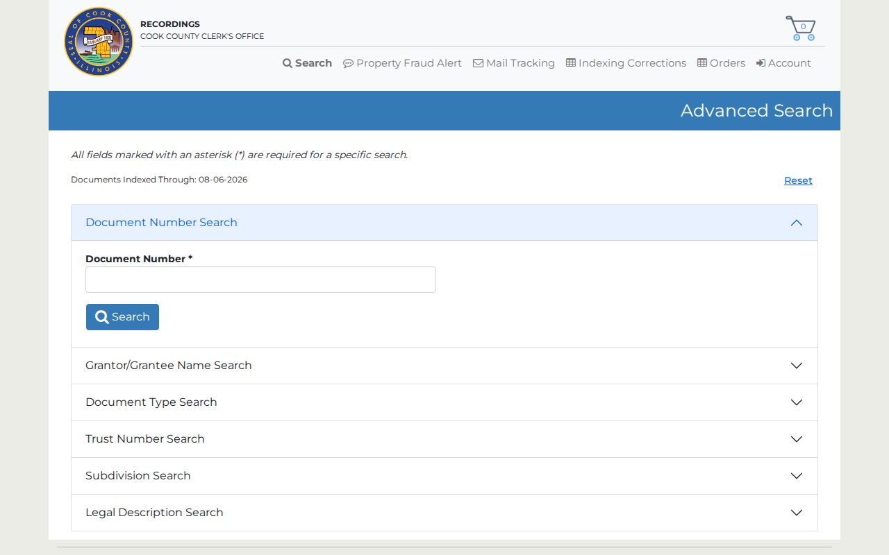
CRS displayed documents indexed through August 6, 2026, but the official page did not establish its earliest online year. Search is free. Images, search-result purchases, and certified copies cost money. If an older Harvey deed does not appear, call the Cook County Clerk Recordings Division at 312-603-5050 or ask about tract books and office-only images at 118 N Clark Street, Room 120, Chicago.
A Harvey Parcel Reality Check
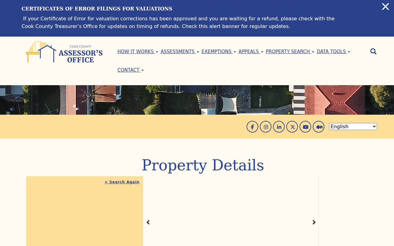
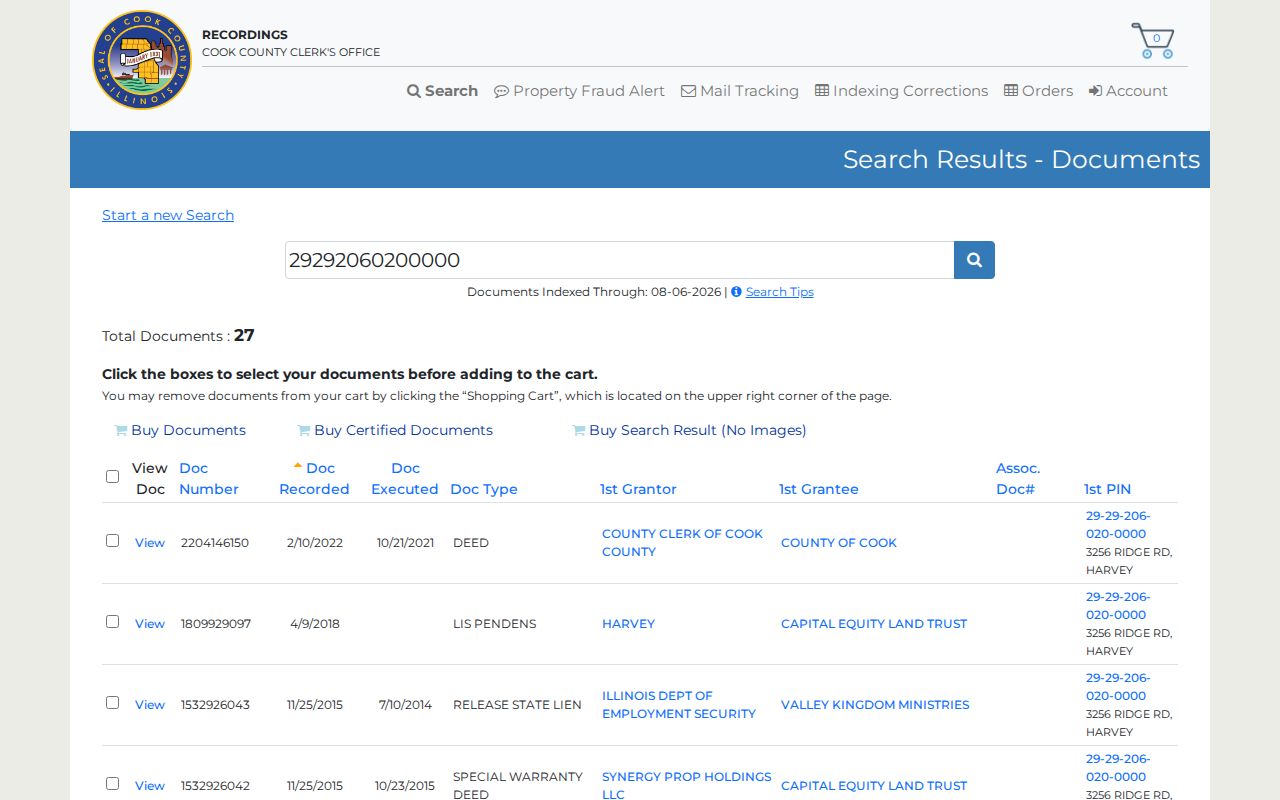
The official sample shows why ownership cannot be read as occupancy. The Assessor card for PIN 29-29-206-020-0000 identifies 3256 Ridge Road in Thornton Township. Its CRS result reports 27 documents. One deed, recorded in 2022, names Cook County and the Cook County Land Bank Authority as grantees. Those public entities are parties to an instrument, not people living at the address.
The sample Harvey parcel card displays the parcel facts.
The linked CRS PIN result presents the recorded-document trail.
Request Harvey Files by Address
Harvey does not publish a searchable permit-history or general resident database. Building and Inspectional Services accepts manual and electronic permit applications, but an address history requires a focused department request. Start with the Harvey permit page or call 708-210-5323. Ask for a street address, date span, permit number if known, and a defined file type.
If the record is not offered through the department, the City Clerk is Harvey's FOIA coordinator. The municipal FOIA page supports an external request portal and mail to the FOIA Officer at City Hall, 15320 Broadway Avenue, Harvey, IL 60426. Illinois FOIA is a route to an existing public record, not a demand that the Clerk create a list of everyone on a street.
Mail requests should identify the record series and a practical date range. Include the preferred electronic or paper format. The City Clerk can route municipal material, while county parcel and recording questions stay with Cook County. Illinois FOIA generally gives a noncommercial request a five-business-day response window, subject to lawful extensions and exemptions. Vital certificates and court files use their own access rules rather than this municipal route.
Read Older Harvey Street Names
Harvey's historical address trail begins before the current city name. The community was known as South Lawn before Harvey became the official name in 1891. Early land work also used Section Eight, plats, the Harvey Land Association, and railroad-linked descriptions. Search both South Lawn and Harvey in old newspapers and land records.
No authoritative street-renaming or renumbering chronology was found. Do not invent a conversion date. When Broadway, Halsted, Dixie, Turlington, or a numbered street fails to match an old item, compare spelling, neighboring lots, lot and block, section-township-range, and the current PIN. The full historical collections belong on the Harvey city directories page, where annual listings can bridge an address across years.
Limits of Harvey Street Directories
A street directory cannot name every member of a Harvey household. Parcel records center on ownership or taxpayer data. Deeds identify legal parties. Permit files identify applicants or contractors. A voter lookup is an individual check using identifying fields, and Illinois law does not turn the statewide voter file into a public street roster. Driver-address data is restricted, utility customer lists are not a public directory, and protected addresses may be withheld or substituted.
Commercial neighbor-search tools may merge stale records and same-name people. Treat such output only as an unverified lead. Official custodians control the meaning and correction of their records. For personal history, estate research, property curiosity, or reconnecting, record the date and role shown by each source.
Lawful use. Use Harvey address records only for lawful personal research. Never use a street search to stalk, harass, threaten, or harm anyone.